Visualizing Billions of Edits to OpenStreetMap
Jennings Anderson
@jenningsatcu | townsendjennings.com
GIS Day 2018

Free & Open Map of the World ?
"Wikipedia of Maps"

An Editable Map
Trace roads, buildings, other real-world objects from satellite imagery
"Wikipedia of Maps"
Aggregate product of
BILLIONS
of edits across
MILLIONS
of objects by
HUNDREDS OF THOUSANDS
of contributors for over a decade
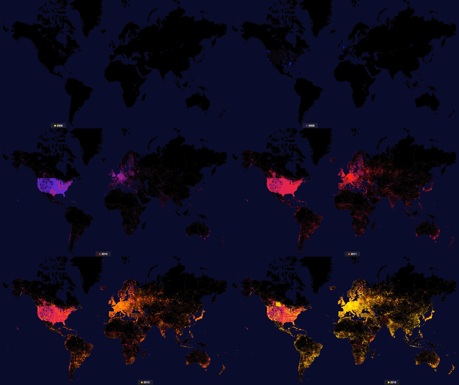
The map is not a single, static rendering of geospatial data, but rather a dynamic and growing community of contributors that maintains an open map of the world.
Contributor-Centric OpenStreetMap Research
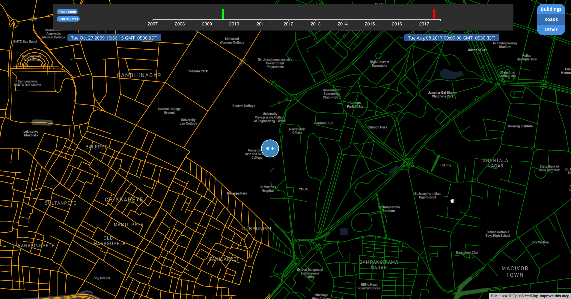
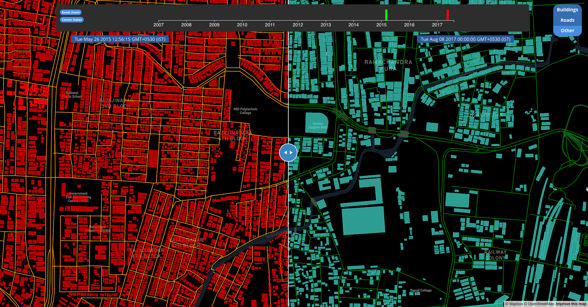
Uncover the history and evolution of the map (and community) through enhanced, historical datasets
Improve reproducibility of results and transparency with definitions of specific measurable attributes and indicators
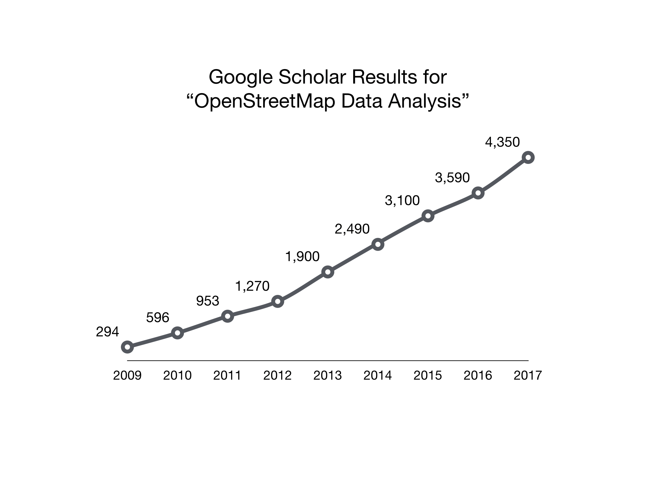
Why is this a hard problem?
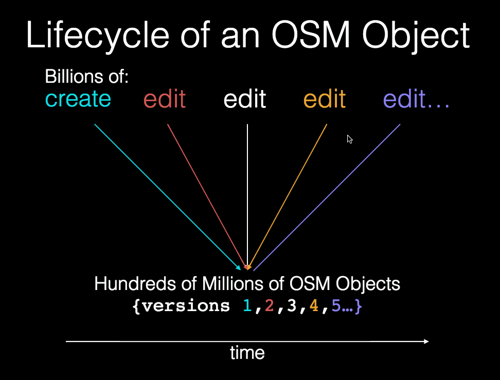
Humanitarian & Disaster Mapping
(What got me interested in OpenStreetMap)

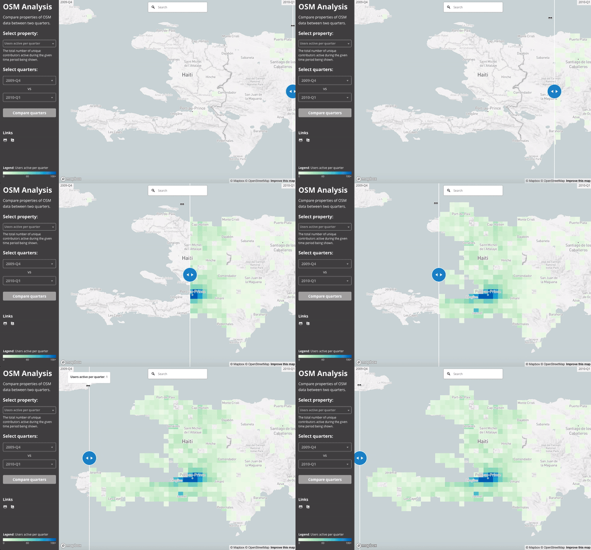
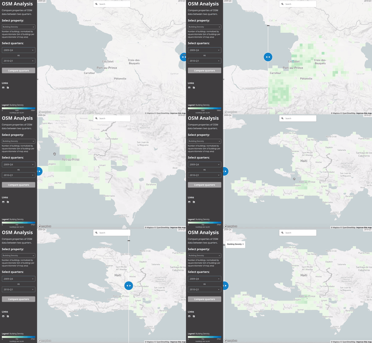
Haiti Earthquake 2010
Active users 2009 vs. 2010
Building Density 2009 vs. 2010

Typhoon Yolanda 2013 (Philippines)

Nepal Earthquake 2015
HistoryBillions of Geographic Points
(& billions of metadata values)
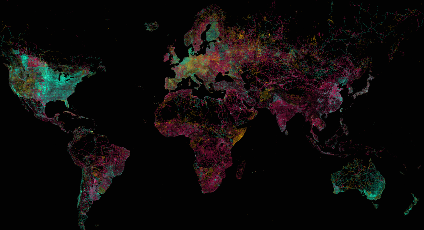
highway = *
Map Data © OpenStreetMap Contributors
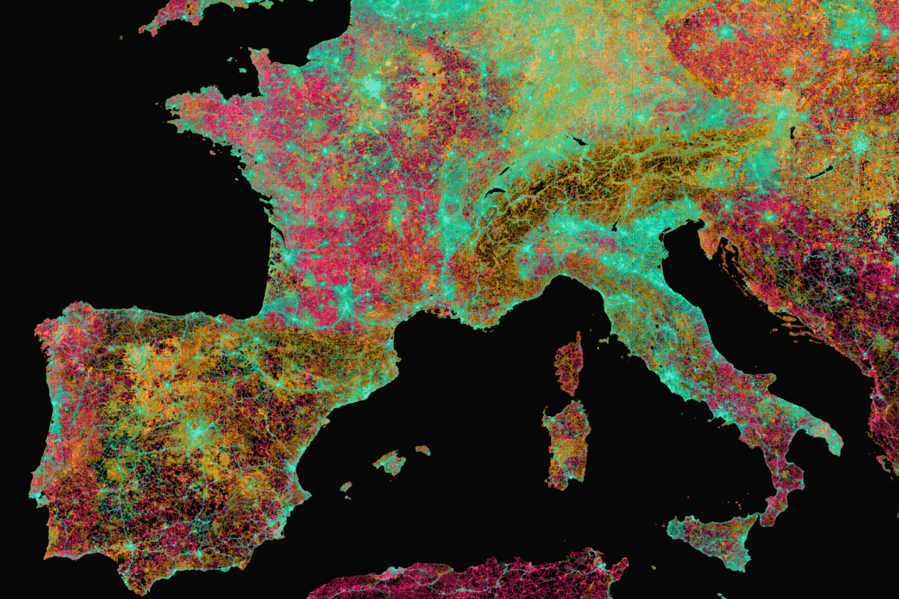
Map Data © OpenStreetMap Contributors
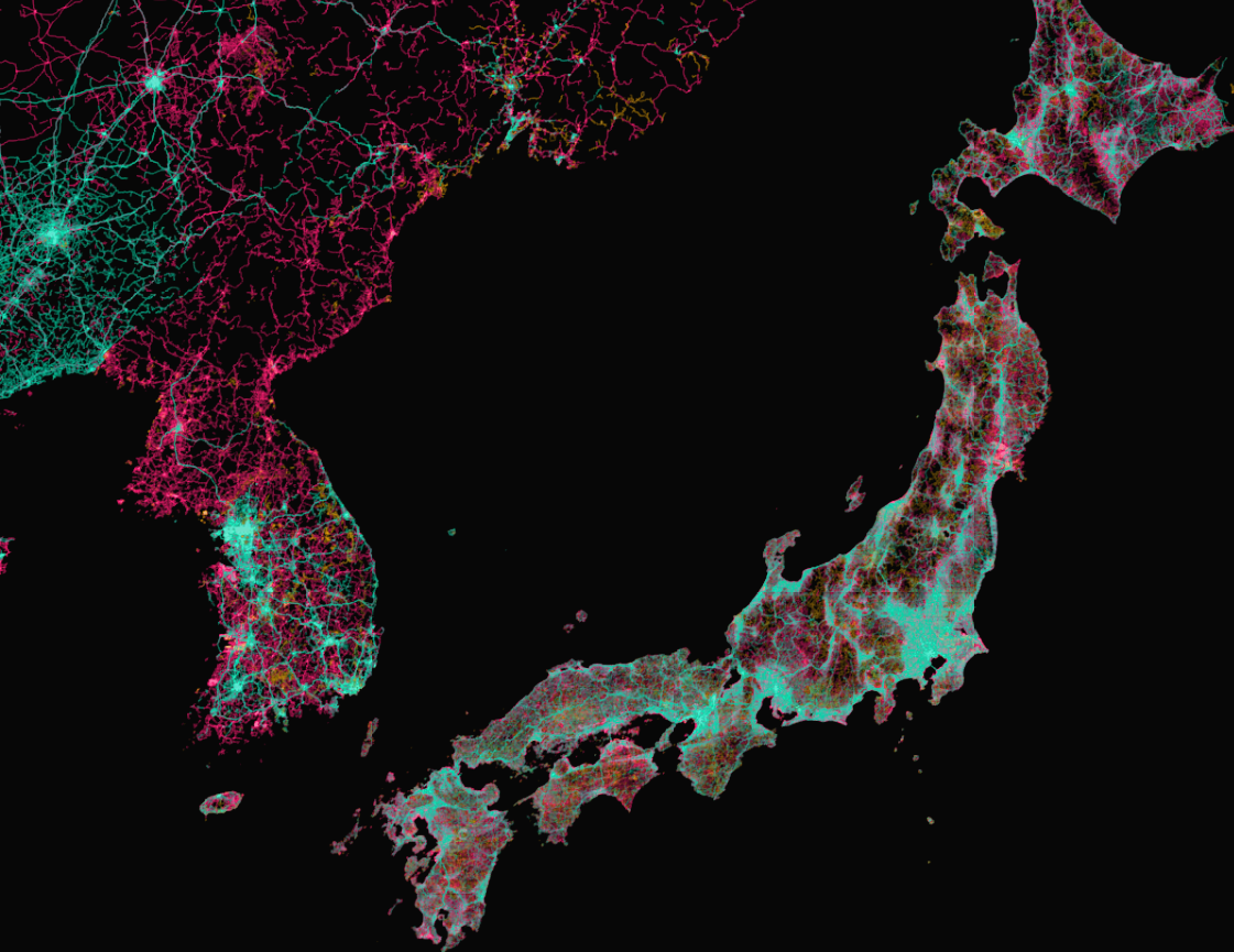
Map Data © OpenStreetMap Contributors
townsendjennings.com/osm-highway-tags
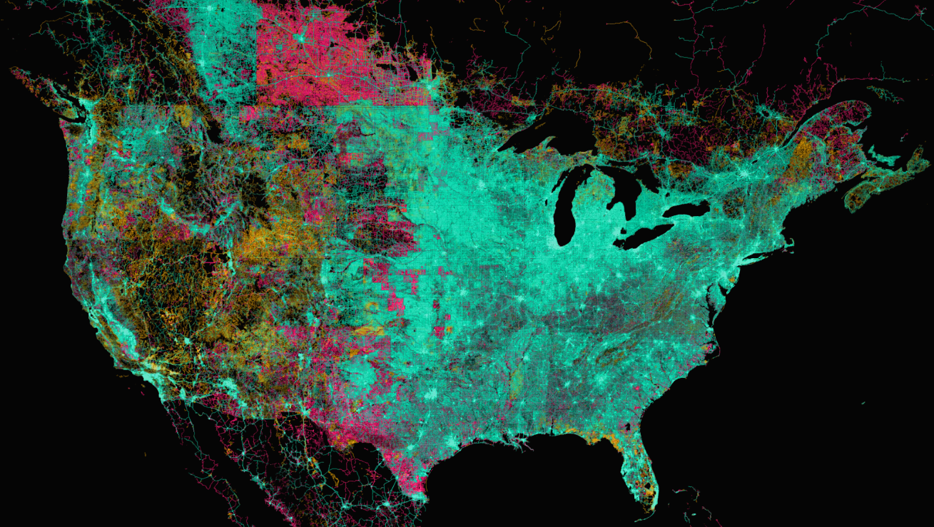
Map Data © OpenStreetMap Contributors
building = *
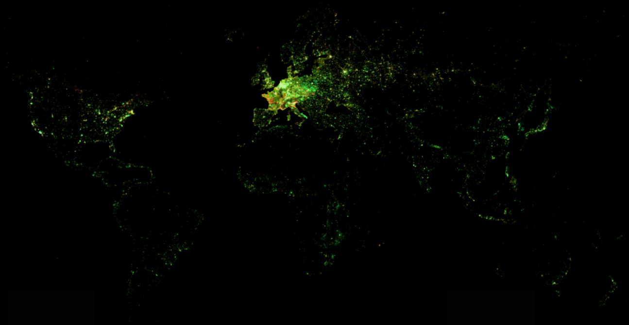
© OpenStreetMap Contributors
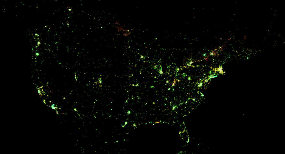
© OpenStreetMap Contributors
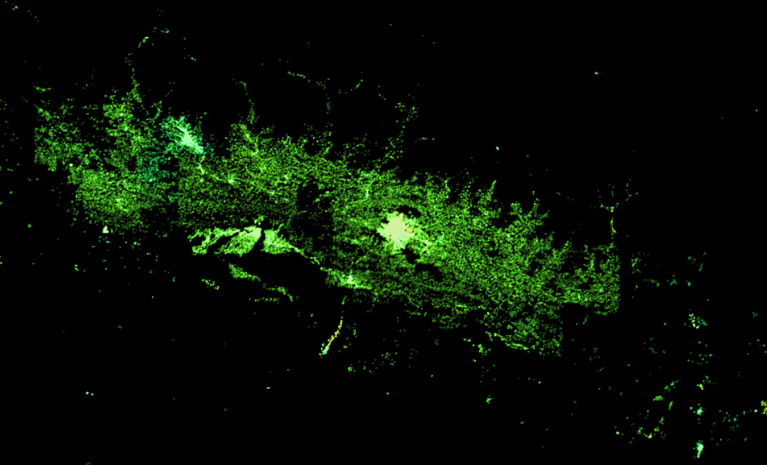
© OpenStreetMap Contributors
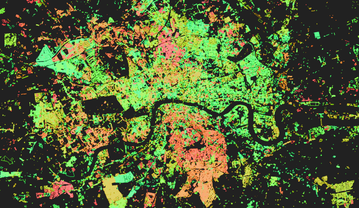
© OpenStreetMap Contributors
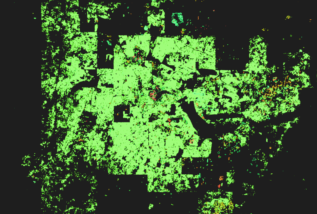
© OpenStreetMap Contributors
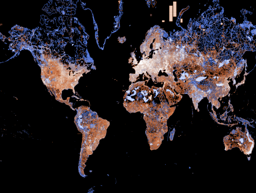
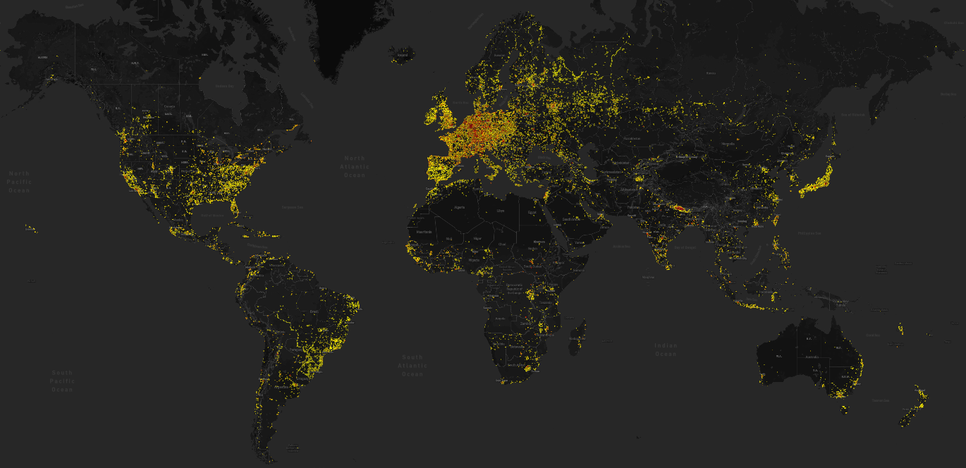
More than 10 editors active in 2015
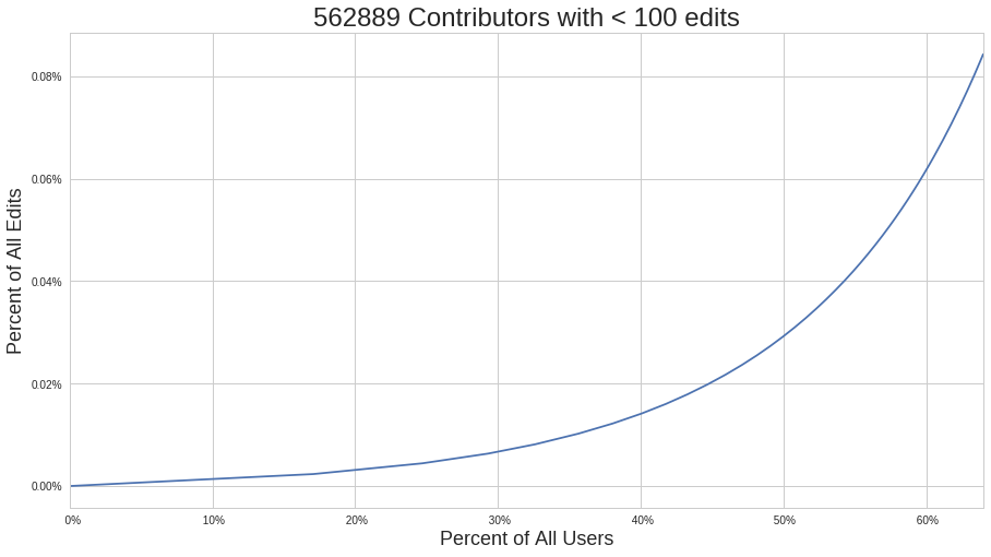
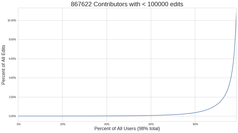
Count of Distinct User IDs in the planet history (June 2017):
879,864With less than 10 edits:
285,231Less than 100 edits:
562,889(Note, a square building = 5 edits: 1 way and 4 nodes)
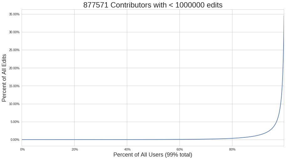
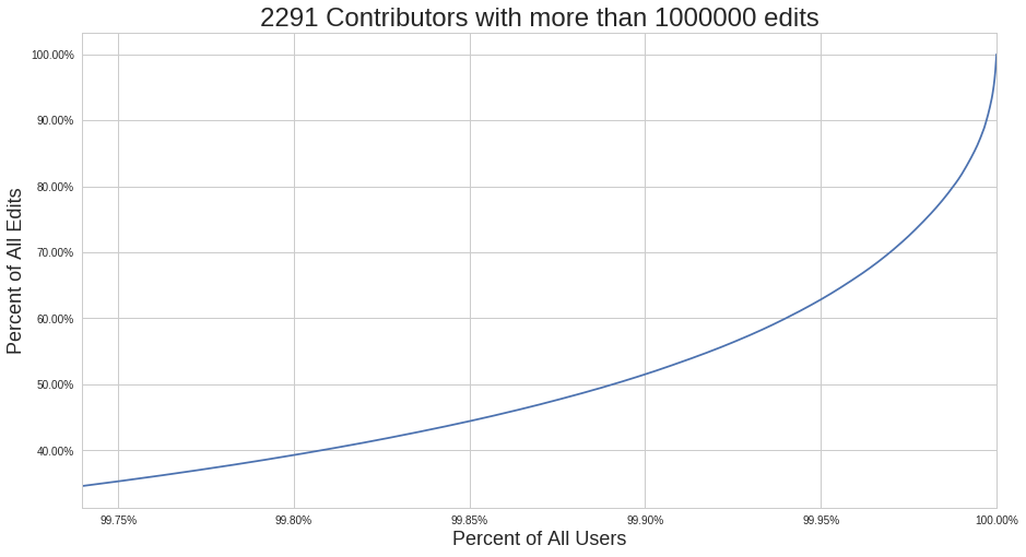
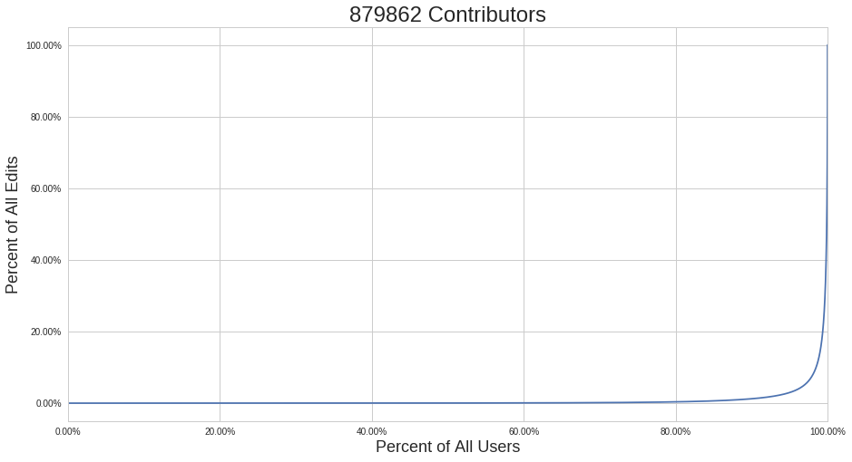
Importance of History
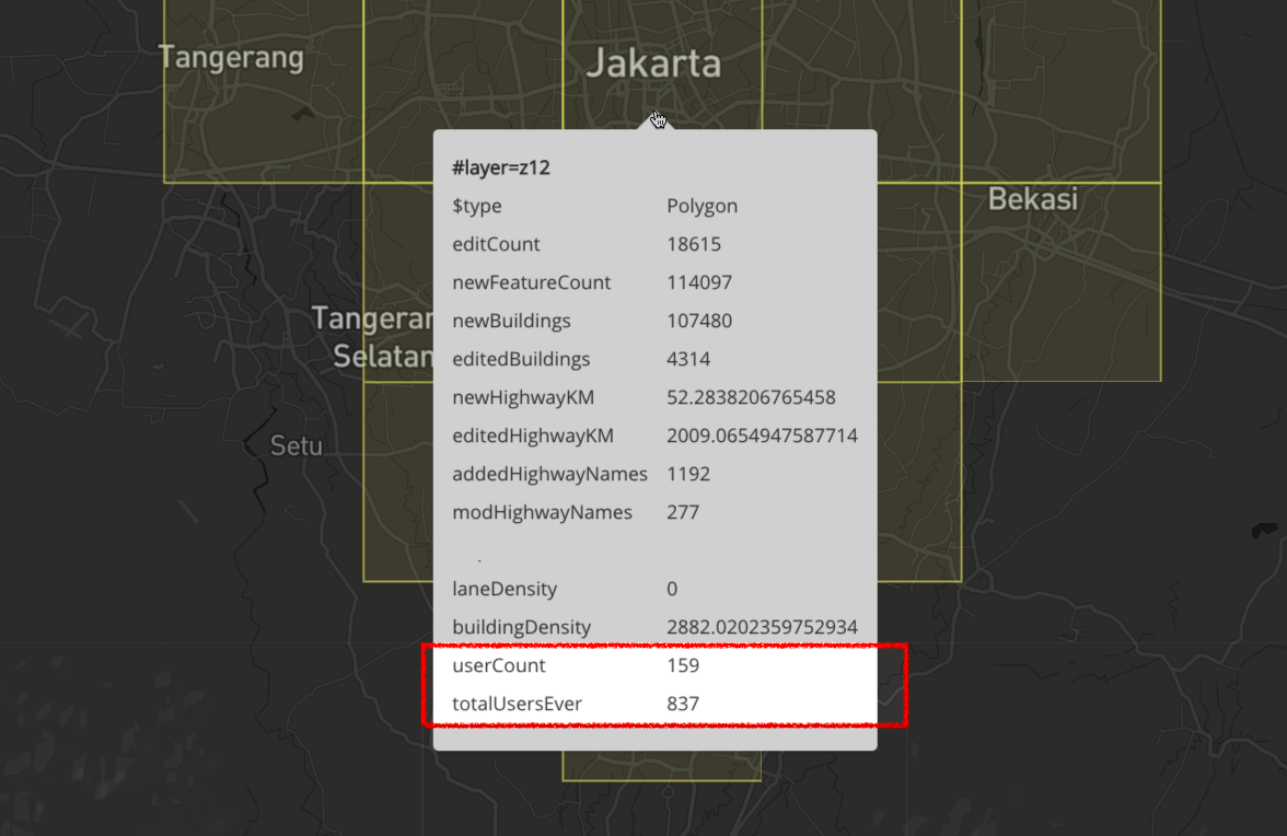
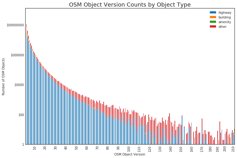
Not all contributions are equal
(clearly)
What about Disaster Mapping?OSM Quality Implications + Disaster Mapping
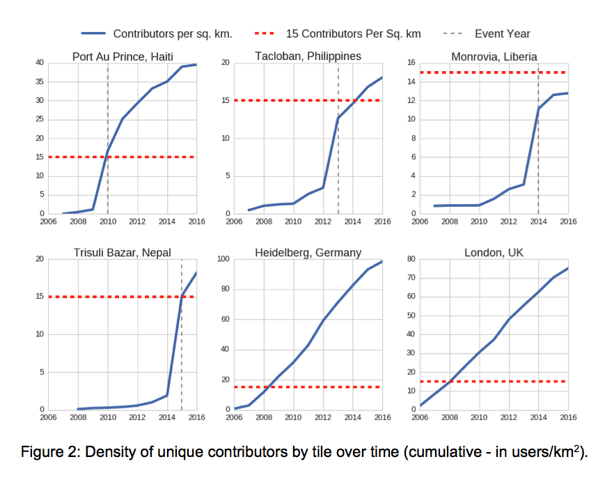
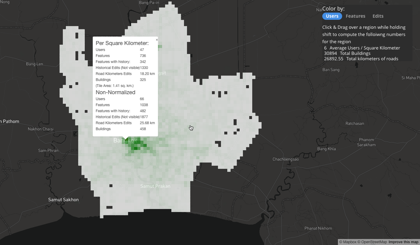
15 Contributors / Square Kilometer
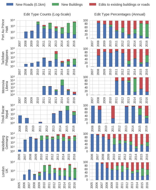
Buildings & Roads?
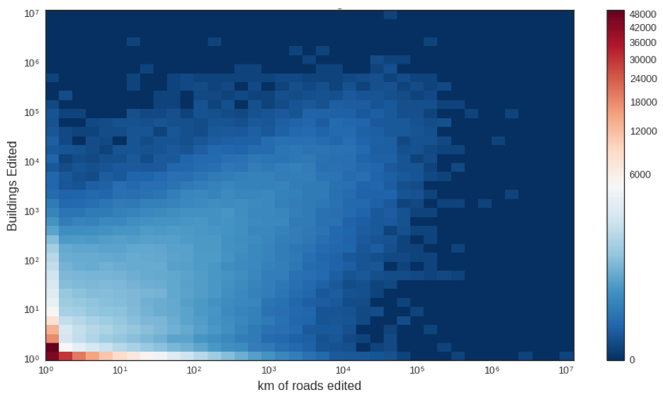
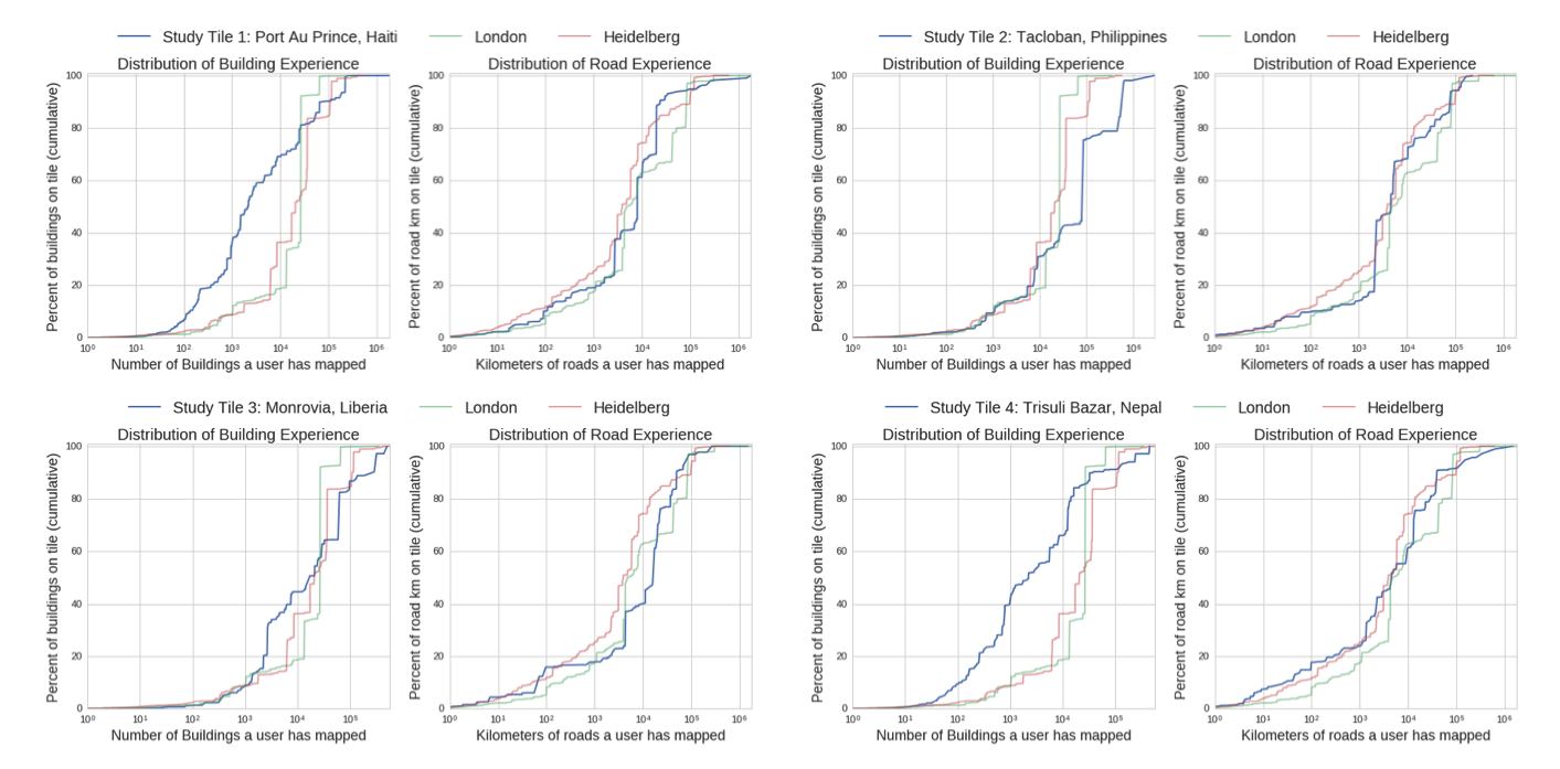
What about compared to high quality regions?
Users By Country
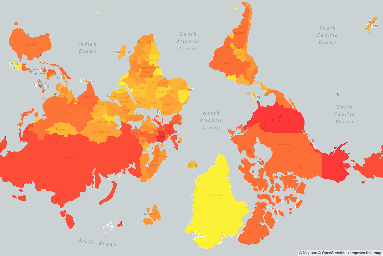
Using the latest osm-qa-tile planet file, we can calculate per-Country statistics for the planet in not a lot of time!
Users By Country
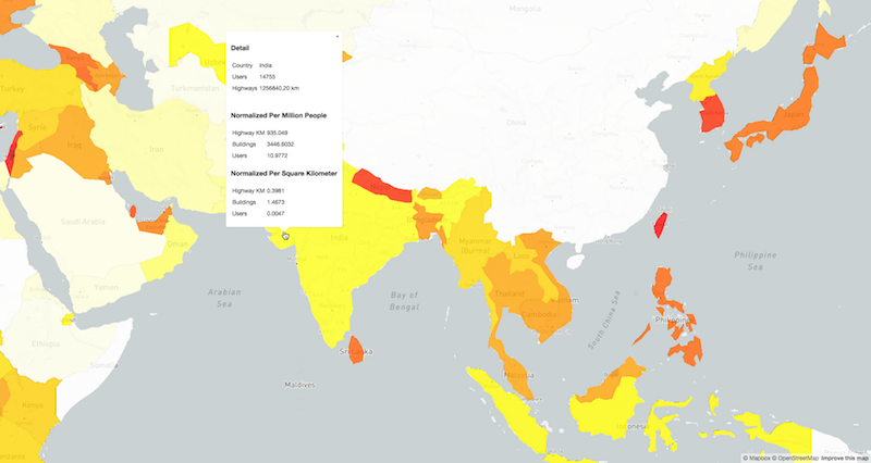
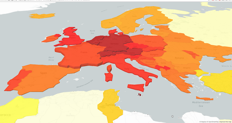
Where are the Contributions?
Mapbox Data Team
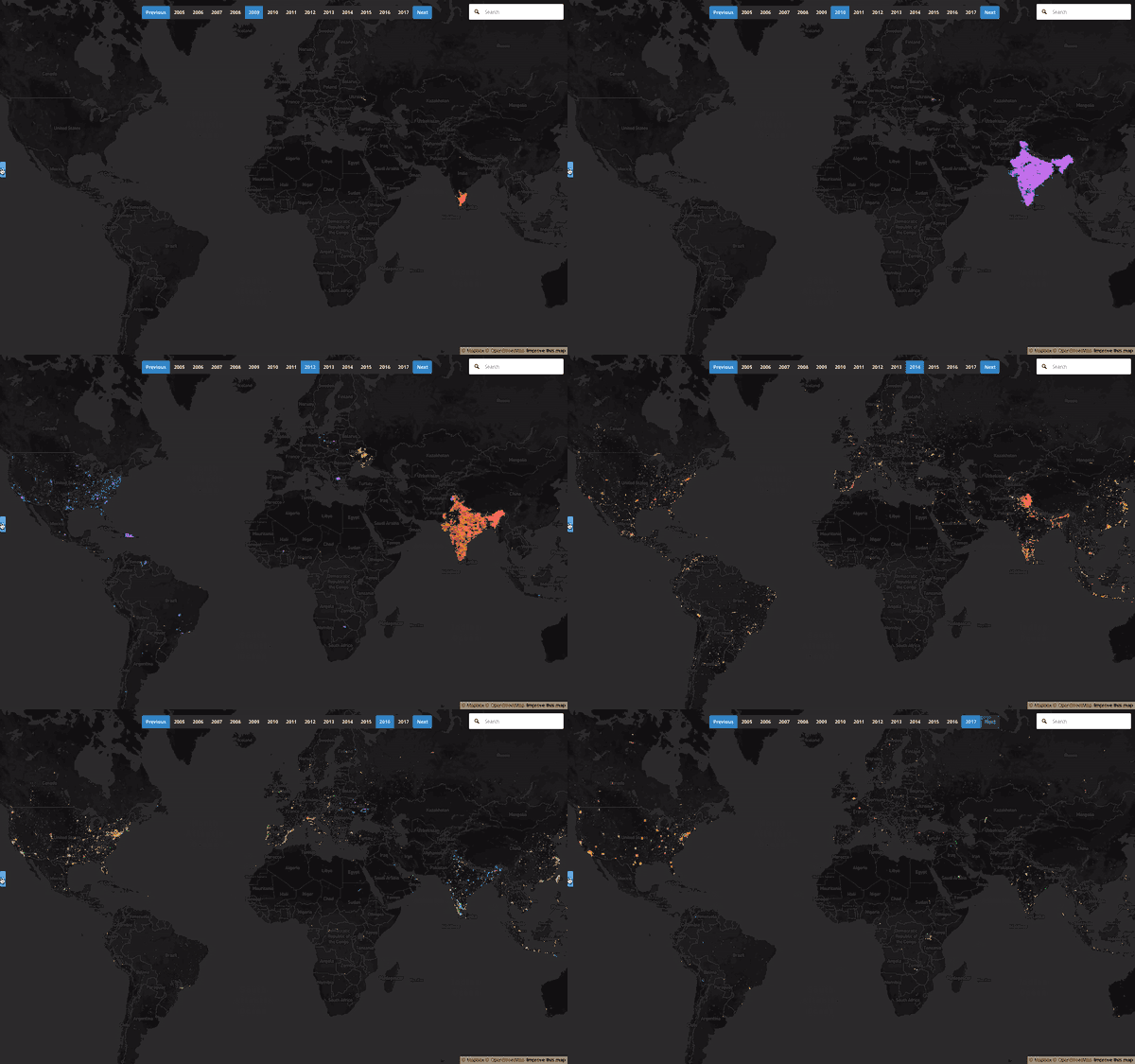
Individual Contributor Histories
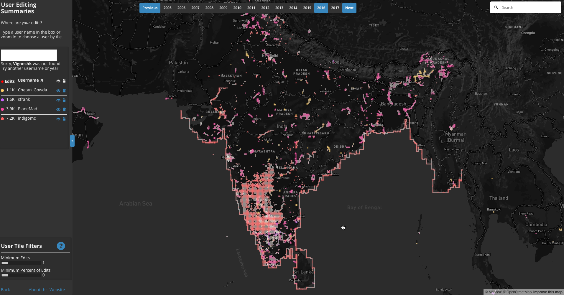
Importance of History


